No products in the cart.
Special Offer: Get 10% off all Offline Courses! Limited time only.
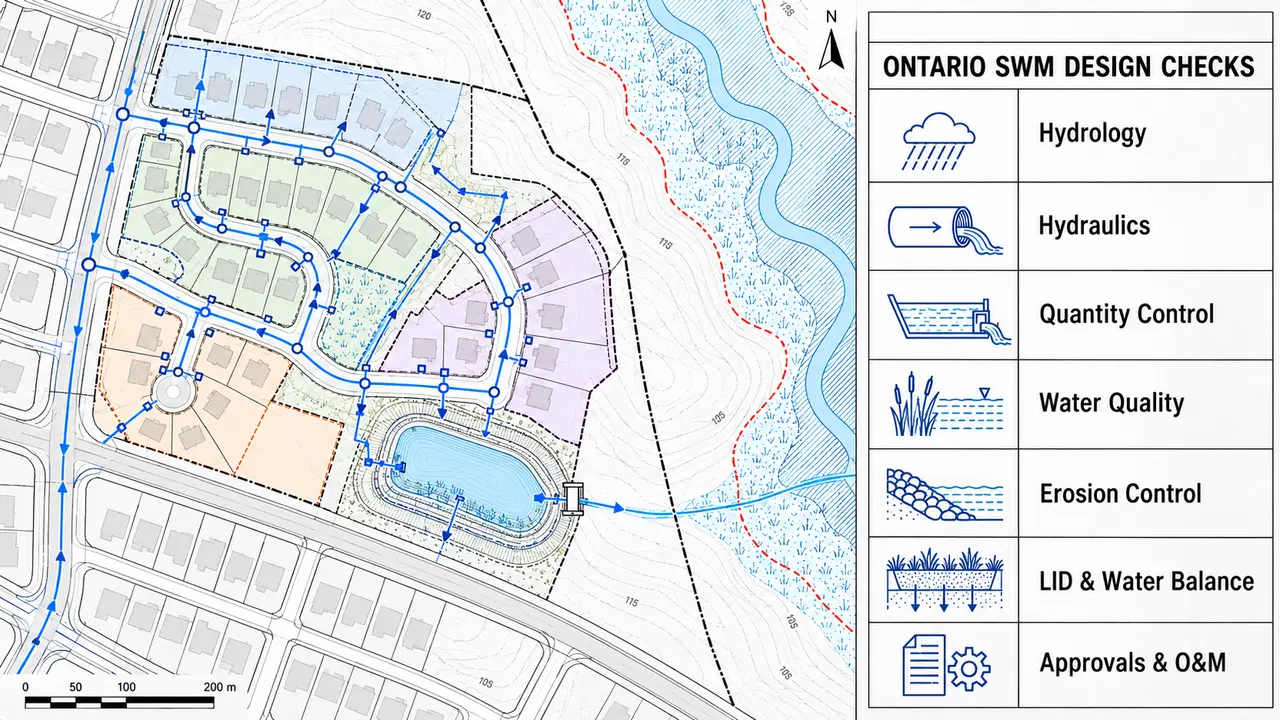
Stormwater management calculations in Ontario are not completed by selecting one rainfall event, comparing two peak flows and sizing a tank. A defensible design connects the site survey, municipal criteria, watershed objectives, hydrologic assumptions, hydraulic capacity, water quality, water balance, erosion control and long-term operation into one traceable submission.
This practical checklist explains what an engineer should confirm before issuing a stormwater management (SWM) report for review. It is written for site plans, subdivisions, redevelopment projects and private stormwater works, but the governing requirements must always be confirmed for the specific site.
Ontario does not have one universal set of numerical SWM criteria for every project. Begin by identifying all authorities and documents that may govern the design:
This step prevents a common failure: completing a technically reasonable model using criteria that the reviewing authority does not accept. Record the source, revision date and section for every major criterion. If two documents conflict, obtain written direction rather than quietly choosing the easier requirement.
Every calculation depends on the quality of the base information. Confirm the legal survey, topographic survey, existing drainage boundaries, elevations, surface cover, buildings, utilities, culverts, inlets, ditches and downstream outlet. Review available geotechnical and hydrogeological information, seasonal groundwater, bedrock, soil infiltration testing and any environmental constraints.
The existing-condition plan should show where runoff actually travels. Property lines alone do not define drainage areas. Check external drainage entering the site, split drainage at high points, low points that store water, and whether an apparent outlet is physically available and legally permitted.
Use the current intensity-duration-frequency (IDF) data and design storms required by the municipality or other approval authority. Do not copy rainfall parameters from a nearby project without checking the station, equation, return period, temporal distribution and climate-change requirements.
Depending on the project and jurisdiction, the analysis may require multiple return periods, more than one storm distribution, continuous simulation, or a sensitivity check. The engineer should understand how the selected rainfall affects peak flow, runoff volume, storage, major-system routing and facility drawdown—not simply whether the software finishes without an error.
For every catchment, document its area, surface type, imperviousness or runoff coefficient, slope, flow path, time of concentration and outlet. The proposed model should reflect the grading design rather than a convenient simplified boundary.
Check that the sum of all modeled catchment areas matches the study area and that the values shown on drainage plans match the model input. Explain any change in off-site drainage, diversion between outlets or uncontrolled area. A reviewer must be able to move from the drawing to the model and reproduce the drainage-area totals.
The Rational Method can be useful for appropriate small catchments and peak-flow calculations when accepted by the authority. More complex sites may require event-based or continuous hydrologic modelling using tools such as OTTHYMO, SWMM or PCSWMM. Software selection does not replace engineering judgment.
For any method, check:
A model should be proportionate to the site, but every influential input needs a defensible source.
The minor system includes elements such as catchbasins, leads, storm sewers and controlled outlets. The major system carries runoff that exceeds minor-system capacity through streets, swales and defined overland routes. Both systems must be coordinated with grading.
Check inlet capture, bypass flow, pipe capacity, hydraulic grade line (HGL), surcharge, tailwater and the elevation relationship between the HGL and vulnerable building openings. Trace the overland route through the site and beyond the property boundary. Confirm that ponding depths, velocities and flow paths meet local criteria and do not direct water toward entrances, accessible routes, neighbouring properties or critical infrastructure.
The allowable release rate may be based on an approved pre-development condition, a municipal unit-flow target, downstream capacity or a watershed-specific criterion. State exactly how the target was established.
Compare controlled and uncontrolled discharge at every outlet. Route the hydrograph through the proposed storage rather than sizing storage from a peak-flow difference alone. Verify stage-storage-discharge relationships, orifice and weir equations, outlet submergence, tailwater, blockage risk and the performance of emergency overflow. Where several controls operate at different elevations, test the transition between them.
Peak-flow control does not necessarily maintain infiltration, evapotranspiration or the timing and volume of runoff. Confirm the applicable water-balance or runoff-volume-control target and calculate how much rainfall is retained, infiltrated, reused or evaporated.
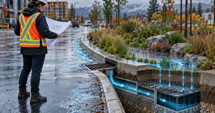
Low Impact Development (LID) practices may include bioretention, infiltration galleries, permeable pavement, green roofs, enhanced swales and rainwater harvesting. Their feasibility depends on soil, groundwater, bedrock, contamination, setback, winter operation and maintenance—not only the available footprint. Ontario’s 2022 LID guidance remains draft guidance and should be identified as such; use it with current municipal, conservation authority and provincial requirements rather than presenting it as a universal final standard.
Establish the required water-quality level and receiving-environment objective. Where enhanced protection applies, Ontario guidance commonly refers to a long-term average removal of 80% of total suspended solids, but the actual requirement and acceptable calculation method must be confirmed for the project.
Use a treatment-train approach where appropriate: source controls, conveyance controls and end-of-pipe measures should work together. For oil-grit separators or other manufactured treatment devices, apply the current local sizing and performance criteria and use verified product information. Do not add removal percentages from separate devices unless the calculation method permits it and avoids double-counting.
Matching a selected peak flow does not automatically protect a stream. Watershed and conservation-authority criteria may require extended detention, erosion thresholds, geomorphic analysis or other controls addressing the frequency and duration of erosive flows.
The TRCA technical guidelines, for example, separately address flooding, water quality, erosion, water balance and natural features. Determine whether the receiving channel, wetland, headwater drainage feature or groundwater-dependent feature creates additional study requirements.
For each facility, check the elevations and volumes associated with permanent pool, sediment storage, active storage, water-quality storage and emergency storage as applicable. Confirm drawdown time, freeboard, side slopes, forebay function, access, outlet protection, anti-seepage provisions and maintenance needs.
For underground systems, confirm structural coordination, access openings, sediment removal, groundwater loading, buoyancy and the consequences of outlet blockage. For infiltration practices, document pretreatment, tested infiltration rate, safety factor, separation from groundwater or bedrock, drawdown and a safe overflow.
Snow storage can occupy ponding areas, block inlets and redirect meltwater. Road salt and fine sediment can affect vegetation, infiltration and receiving-water quality. Show snow-storage locations and confirm that winter maintenance will not defeat the drainage strategy.
The owner must be able to inspect and maintain the system after construction. Identify inspection frequency, sediment-removal triggers, vegetation care, device servicing, record keeping and responsibility. Ontario’s current EASR guidance requires an operation and maintenance manual within the SWM report for works that qualify for registration.
Ontario’s environmental-permission framework is changing. Certain private stormwater works meeting the criteria of Ontario Regulation 137/25 may require registration in the EASR, while other works may require an ECA or may fall within another approval or exemption.
For an EASR-eligible project, the province’s guidance for preparing a SWM report requires a report prepared, signed and sealed by a licensed engineering practitioner. The report addresses the site assessment, design, monitoring assessment, operation and maintenance, and erosion and sediment control. Eligibility should be confirmed before construction; EASR is not simply a faster substitute for every ECA.
Post-construction controls cannot protect the receiving system if sediment escapes during construction. Coordinate phasing, stabilized access, perimeter controls, inlet protection, temporary drainage, sediment traps, dewatering, inspection after rainfall and progressive stabilization. The erosion and sediment control plan should reflect the actual construction sequence and identify who is responsible for inspection and corrective action.
Before submission, complete an independent check that covers more than formatting:
A strong SWM report allows the reviewer to follow the complete chain from governing criterion to input, calculation, drawing, result and maintenance requirement.
Competence in stormwater design requires more than learning one modelling program. An engineer should understand hydrology, open-channel and pipe hydraulics, grading, storm sewer design, detention routing, LID and water balance, water quality, erosion and fluvial geomorphology, geotechnical and hydrogeological constraints, environmental permissions, construction sequencing, and technical report preparation. Civil 3D, GIS and modelling software support the work, but they do not decide whether the assumptions are correct.
BackToSkill can help businesses train technical staff in practical stormwater-management workflows aligned with Canadian project expectations. Training can be adapted to the organization’s typical projects, staff experience and operational needs, including calculation workflows, model review, drawing coordination and SWM report preparation.
BackToSkill also supports engineers, designers and technical professionals who want to strengthen their SWM knowledge, take on greater project responsibility or prepare for career advancement. The focus is practical: understanding why calculations are performed, how inputs are verified and how engineering decisions are documented for review.
Explore BackToSkill’s practical Stormwater Management and Site Development training or contact us to discuss team training.
This article is an educational checklist, not a substitute for project-specific engineering judgment, current legislation, approval conditions or direction from the responsible authorities.



Not a member yet? Register now
Are you a member? Login now